
Description
DJI Zenmuse L2: Unmatched LiDAR Precision
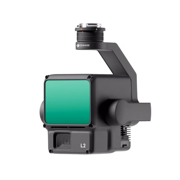
The DJI Zenmuse L2 is an advanced LiDAR payload designed to deliver exceptional performance in aerial mapping, surveying, and other precision-based tasks. Integrated with DJI’s enterprise-grade drones, the Zenmuse L2 offers unparalleled accuracy, with a powerful LiDAR sensor, 20 MP RGB camera, and robust real-time processing capabilities. Whether you are working on large-scale infrastructure projects, environmental mapping, or disaster management, the Zenmuse L2 is engineered to help professionals achieve the highest level of precision in their field.
Technical Specifications Of The DJI Zenmuse L2
General Specifications
Product Name: Zenmuse L2
Dimensions: 155×128×176 mm (L×W×H)
Weight: 905±5 g
Power: 28 W (typical), 58 W (max.)
IP Rating: IP54
Storage Temperature: -20° to 60° C (-4° to 140° F)
Operating Temperature: -20° to 50° C (-4° to 122° F)
System Performance
Detection Range:
450m @ 50% reflectivity, 0 klx
250m @ 10% reflectivity, 100 klx
Maximum detection range: 500 m
Point Cloud Rate:
Single return: 240,000 pts/s
Multiple returns: 1,200,000 pts/s
System Accuracy:
Horizontal: 5 cm @ 150 m
Vertical: 4 cm @ 150 m
Real-Time Point Cloud Coloring Coding: Reflectivity, Height, Distance, RGB
LiDAR Specifications
Ranging Accuracy (RMS 1σ): 2 cm @ 150 m
Maximum Returns Supported: 5
Scanning Modes:
Non-repetitive scanning pattern
Repetitive scanning pattern
Laser Wavelength: 905 nm
Laser Beam Divergence: Horizontal 0.2 mrad, Vertical 0.6 mrad
Laser Pulse Emission Frequency: 240 kHz
Laser Safety: Class 1 (IEC 60825-1:2014)
IMU System
IMU Update Frequency: 200 Hz
Accelerometer Range: ±6 g
Angular Velocity Meter Range: ±300 dps
Horizontal Positioning Accuracy: RTK FIX: 1 cm + 1 ppm
Vertical Positioning Accuracy: RTK FIX: 1.5 cm + 1 ppm
RGB Mapping Camera
Sensor: 4/3 CMOS, 20 MP
Lens: 24 mm equivalent focal length, f/2.8-f/11 aperture
Shutter Speed: 2-1/2000 s (Mechanical), 2-1/8000 s (Electronic)
Photo Format: JPEG/DNG (RAW)
Video Format: MP4 (MPEG-4 AVC/H.264 or HEVC/H.265)
ISO: Video: 100-6400; Photo: 100-6400
Gimbal
Stabilization: 3-axis (tilt, roll, pan)
Mounting: Detachable DJI SKYPORT
Mechanical Range:
Tilt: -143° to +43°
Pan: ±105°
Controllable Range:
Tilt: -120° to +30°
Pan: ±90°
Data Storage
Raw Data Storage: Photo/IMU/Point cloud/GNSS/Calibration files
Point Cloud Data Storage: Real-time modeling data storage
Supported microSD Cards:
Lexar 1066x 64GB U3 A2 V30 microSDXC
Kingston Canvas Go! Plus 128GB U3 A2 V30 microSDXC
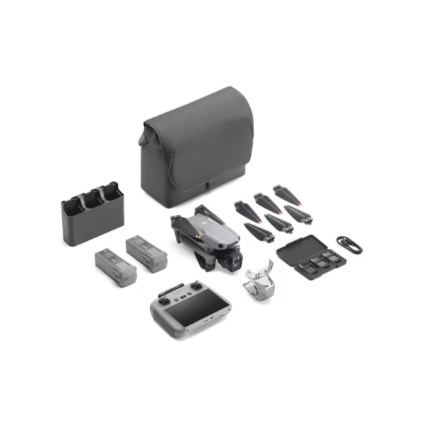
DJI Zenmuse L2 Compatibility
The Zenmuse L2 is compatible with the–
- DJI MATRICE 300 RTK and the
- DJI MATRICE 350 RTK,
two of DJI’s top enterprise drones. With these aircraft, the Zenmuse L2 integrates seamlessly, delivering high-precision LiDAR and imaging data for various industries, including surveying, construction, agriculture, and more.
Applications Of DJI Zenmuse L2
Aerial Surveying And Mapping
- Achieve precise 3D models for land mapping and urban planning.
- Ideal for large-scale terrain modeling and volumetric measurements.
Infrastructure Inspection
- Quickly assess the condition of bridges, buildings, and powerlines with detailed point clouds and imagery.
- Provides accurate measurements in hard-to-reach areas.
Environmental Monitoring
- Monitor forests, rivers, and natural landscapes with high-detail LiDAR data for vegetation mapping and terrain analysis.
- Useful in flood modeling, forest management, and habitat conservation.
Agriculture
- Conduct crop health assessments, soil analysis, and irrigation planning.
- Help farmers optimize land use and improve yields with detailed 3D mapping and vegetation analysis.
Search And Rescue Operations
- Assist in disaster recovery efforts by providing quick, accurate terrain data.
- Enable rescue teams to navigate difficult environments and locate survivors.
Most Searched Questions About The DJI Zenmuse L2
Answer: The maximum detection range is 500 meters under optimal conditions.
Comparison Of DJI Zenmuse L2 VS. DJI Zenmuse L1
| FEATURE | DJI ZENMUSE L2 | DJI ZENMUSE L1 |
|---|---|---|
| DETECTION RANGE | 500 m (max) | 450 m (max) |
| RANGING ACCURACY (RMS 1Σ) | 2 cm @ 150 m | 5 cm @ 100 m |
| POINT CLOUD RATE | Single return: 240,000 pts/s; Multiple returns: 1,200,000 pts/s | Single return: 240,000 pts/s; Multiple returns: 600,000 pts/s |
| SYSTEM ACCURACY | Horizontal: 5 cm @ 150 m; Vertical: 4 cm @ 150 m | Horizontal: 5 cm @ 100 m; Vertical: 10 cm @ 100 m |
| LASER WAVELENGTH | 905 nm | 905 nm |
| LASER BEAM DIVERGENCE | Horizontal: 0.2 mrad, Vertical: 0.6 mrad | Horizontal: 0.3 mrad, Vertical: 0.9 mrad |
| MAXIMUM RETURNS SUPPORTED | 5 | 5 |
| SCANNING MODES | Non-repetitive, Repetitive | Non-repetitive, Repetitive |
| RGB CAMERA | 20 MP RGB camera (4/3 CMOS) | 20 MP RGB camera (4/3 CMOS) |

Reviews
There are no reviews yet.